Please use this identifier to cite or link to this item:
https://elib.psu.by/handle/123456789/18383Full metadata record
| DC Field | Value | Language |
|---|---|---|
| dc.contributor.author | Михеева, А. А. | - |
| dc.date.accessioned | 2016-12-29T05:42:41Z | - |
| dc.date.available | 2016-12-29T05:42:41Z | - |
| dc.date.issued | 2016 | |
| dc.identifier.citation | Геодезия, картография, кадастр, ГИС – проблемы и перспективы развития : материалы междунар. науч.-практ. конф., Новополоцк, 9–10 июня 2016 г. : в 2 ч. / М-во образования РБ, Полоцкий гос. ун-т ; редкол.: Г. А. Шароглазова [и др.]. – Новополоцк : ПГУ, 2016. – Ч. 1. – C. 188 | ru_RU |
| dc.identifier.isbn | 978-985-531-543-9 (Ч. 1) | - |
| dc.identifier.uri | https://elib.psu.by/handle/123456789/18383 | - |
| dc.description | ANALYSIS OF FORMULAE FOR RESOLUTION CALCULATION WHEN SCANNING THE AERIAL NEGATIVES A. MIKHEEVA | ru_RU |
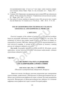
| dc.description.abstract | Выполнен анализ для формул расчета разрешения при сканировании аэронегативов, приведенных в Инструкции по фотограмметрическим работам при создании топографических карт и планов. В основу разработки положена Инструкция по фотограмметрическим работам по созданию цифровых топографических карт и планов Роскартографии. Нормативно-технические документы должны неоднократно редактироваться и все требования тщательно проверяться, чего не было сделано с рассматриваемыми инструкциями.=The paper examined the formulae for resolution calculation when scanning the aerial negatives provided by the Instructions for photo charting work while creating topographic maps or plans. – Minsk, Belarusian National Scien197 tific Research Center for Survey, 2003. The authors of the specified document posit that its conceptual basis lies in the Instruction for charting work while creating topographic maps or plans at Roskartographia, Moscow, Central Scientific Research Center for Survey, 2002. The instructions should be edited multiple times and all requirements must be thoroughly validated, which was not completed for the mentioned documents. | ru_RU |
| dc.language.iso | ru | ru_RU |
| dc.publisher | Полоцкий государственный университет | ru_RU |
| dc.subject | Геоинформационные системы | ru_RU |
| dc.subject | Геоинформационные технологии | ru_RU |
| dc.subject | Дистанционное зондирование территории | ru_RU |
| dc.subject | Geographic Information systems | ru_RU |
| dc.subject | Remote sensing area | ru_RU |
| dc.subject | aerial photography | ru_RU |
| dc.subject | preliminary accuracy calculation | ru_RU |
| dc.subject | aerial negatives | ru_RU |
| dc.title | Анализ формул расчета разрешения при сканировании аэронегативов | ru_RU |
| dc.type | Article | ru_RU |
| dc.identifier.udc | 528.7 | - |
| Appears in Collections: | Геодезия, картография, кадастр, ГИС – проблемы и перспективы развития. 2016 | |
Files in This Item:
| File | Description | Size | Format | |
|---|---|---|---|---|
| Михеева_с188-197.pdf | 176.2 kB | Adobe PDF |  View/Open |
Items in DSpace are protected by copyright, with all rights reserved, unless otherwise indicated.