Please use this identifier to cite or link to this item:
https://elib.psu.by/handle/123456789/18395Full metadata record
| DC Field | Value | Language |
|---|---|---|
| dc.contributor.author | Шароглазова, Г. А. | - |
| dc.contributor.author | Маркович, К. И. | - |
| dc.contributor.author | Святогоров, А. А. | - |
| dc.contributor.author | Ялтыхов, В. В. | - |
| dc.date.accessioned | 2016-12-29T11:33:31Z | - |
| dc.date.available | 2016-12-29T11:33:31Z | - |
| dc.date.issued | 2016 | |
| dc.identifier.citation | Геодезия, картография, кадастр, ГИС – проблемы и перспективы развития : материалы междунар. науч.-практ. конф., Новополоцк, 9–10 июня 2016 г. : в 2 ч. / М-во образования РБ, Полоцкий гос. ун-т ; редкол.: Г. А. Шароглазова [и др.]. – Новополоцк : ПГУ, 2016. – Ч. 1. – C. 90 | ru_RU |
| dc.identifier.isbn | 978-985-531-543-9 (Ч. 1) | - |
| dc.identifier.uri | https://elib.psu.by/handle/123456789/18395 | - |
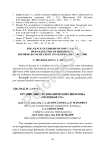
| dc.description | ORGANIZATION OF GEODYNAMIC POLYGON «POLOTSK HYDROELECTRIC POWER STATION» G. SHAROGLAZOVA, К. MARKOVICH, А. SVYATOGOROV, V. YALTYHOV | ru_RU |
| dc.description.abstract | Рассматривается организация классического геодинамического полигона на территории, подверженной взаимообусловленному влиянию тектонических и техногенных факторов. Показана необходимость участия при проектировании полигона специалистов различных наук о Земле. Особое внимание уделено качественной закладке центров геодезических пунктов и их оптимальному расположению, а также методике высокоточных геодезических измерений и математической обработке результатов этих измерений.=Article is devoted to the organization of the classical geodynamic ground in the territory subject to interdependent influence of tectonic and anthropogenic factors. Need of participation at projection of the ground of experts of various sciences about Earth is shown. The special attention is given to qualitative laying of the centers of geodetic points and their optimum arrangement, and also a technique of high-precision geodetic measurements and mathematical processing of results of these measurements. | ru_RU |
| dc.language.iso | ru | ru_RU |
| dc.publisher | Полоцкий государственный университет | ru_RU |
| dc.subject | Геодезия | ru_RU |
| dc.subject | гравиметрия | ru_RU |
| dc.subject | геодинамика | ru_RU |
| dc.subject | Geodesy | ru_RU |
| dc.subject | gravimetry | ru_RU |
| dc.subject | geodynamics | ru_RU |
| dc.subject | современные движения земной коры | ru_RU |
| dc.subject | дистанционное зондирование | ru_RU |
| dc.subject | modern movements of the Earth's crust | ru_RU |
| dc.subject | remote sensing tectonic fault | ru_RU |
| dc.title | Организация геодинамического полигона «Полоцкая ГЭС» | ru_RU |
| dc.type | Article | ru_RU |
| dc.identifier.udc | 528.22.551.24 (075.8) | - |
| Appears in Collections: | Геодезия, картография, кадастр, ГИС – проблемы и перспективы развития. 2016 | |
Files in This Item:
| File | Description | Size | Format | |
|---|---|---|---|---|
| Шароглазова_с90-103.pdf | 1.57 MB | Adobe PDF |  View/Open |
Items in DSpace are protected by copyright, with all rights reserved, unless otherwise indicated.