Please use this identifier to cite or link to this item:
https://elib.psu.by/handle/123456789/21622Full metadata record
| DC Field | Value | Language |
|---|---|---|
| dc.contributor.author | Михеева, А. А. | - |
| dc.contributor.author | Ялтыхов, В. В. | - |
| dc.contributor.author | Лакотка, Е. В. | - |
| dc.date.accessioned | 2018-03-23T06:53:03Z | - |
| dc.date.available | 2018-03-23T06:53:03Z | - |
| dc.date.issued | 2017 | - |
| dc.identifier.citation | Вестник Полоцкого государственного университета. Серия F, Строительство. Прикладные науки. - 2017. - № 16. - С. 162-171. | ru_RU |
| dc.identifier.issn | 2070-1683 | - |
| dc.identifier.uri | https://elib.psu.by/handle/123456789/21622 | - |
| dc.description | The Analysis of Accuracy of Coordinates Definition Using Images Made By Camera Ads-100 A. Mikheeva, V. Yaltykhov, E. Lakotka | ru_RU |
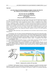
| dc.description.abstract | Рассматривается аэрофотосъемка, выполняемая аэрокамерой ADS-100. В фокальной плоскости объектива аэрокамеры расположены три ПЗС-линейки, отстоящие друг от друга таким образом, что одна из них обеспечивает съемку в направлении «вперед», другая – в направлении точки надира, третья – в направлении «назад». Таким образом, каждая точка местности оказывается снятой тремя сенсорами, обеспечивая тройное перекрытие, что создает дополнительный контроль при определении координат точек. В работе выполнена оценка точности полученных результатов по эллипсам погрешностей в трех вариантах: при съемке местности линейками ПЗС в направлениях вперед и назад; при съемке – вперед и в надир и при съемке в надир и назад. Самым точным оказался первый способ. Совместное использование всех трех вариантов позволяет повысить точность на 20% при сравнении с первым вариантом.= In the recent time the aerial survey in Belarus is made with the air camera ADS-100. There are three ССD rulers located on the focusing plane of the air camera lens in such a way that one of them provides the footage in the front, the second – in the plate nadir direction, the third – in the back. Therefore, each point is shot with three sensors providing triple coverage, which creates additional control over the point coordinates determination. The paper examines the accuracy of the results using ellipse of errors for three options: aerial survey with the CCD rulers in the front and back; in the front and in the plate nadir direction, and in the plate nadir direction and back. The first method proved to be the most accurate. The combination of the three methods increases the accuracy by 20% compare to the first method. | ru_RU |
| dc.language.iso | ru | ru_RU |
| dc.publisher | Полоцкий государственный университет | ru_RU |
| dc.relation.ispartof | Веснік Полацкага дзяржаўнага ўніверсітэта. Серыя F, Будаўніцтва. Прыкладныя навукі | be_BE |
| dc.relation.ispartof | Herald of Polotsk State University. Series F, Civil engineering. Applied sciences | en_EN |
| dc.relation.ispartof | Вестник Полоцкого государственного университета. Серия F. Строительство. Прикладные науки | ru_RU |
| dc.relation.ispartofseries | Серия F. Строительство. Прикладные науки;2017. - № 16 | - |
| dc.rights | open access | ru_RU |
| dc.subject | Государственный рубрикатор НТИ - ВИНИТИ::ЕСТЕСТВЕННЫЕ И ТОЧНЫЕ НАУКИ::Геодезия. Картография | ru_RU |
| dc.subject | Аэрокамера | ru_RU |
| dc.subject | Съемка | ru_RU |
| dc.subject | Координаты точек местности | ru_RU |
| dc.subject | Оценка точности | ru_RU |
| dc.subject | Эллипсы погрешностей | ru_RU |
| dc.subject | aerocamera | ru_RU |
| dc.subject | Survey | ru_RU |
| dc.subject | Coordinates location | ru_RU |
| dc.subject | Accuracy assessment | ru_RU |
| dc.subject | The ellipses of errors | ru_RU |
| dc.title | Анализ точности определения координат точек местности по снимкам, полученным аэрокамерой ADS-100 | ru_RU |
| dc.type | Article | ru_RU |
| dc.identifier.udc | 528.71 | - |
| Appears in Collections: | 2017, № 16 | |
Files in This Item:
| File | Description | Size | Format | |
|---|---|---|---|---|
| 162-171.pdf | 246.41 kB | Adobe PDF |  View/Open |
Items in DSpace are protected by copyright, with all rights reserved, unless otherwise indicated.